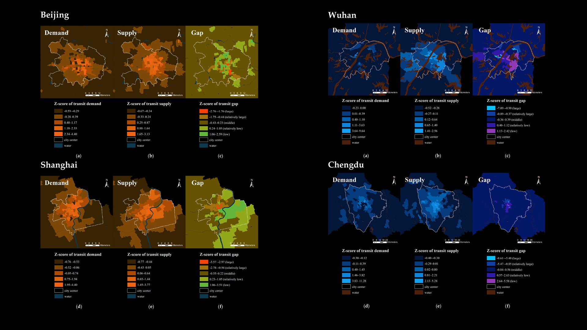
Using Open Source Data to Identify Transit Deserts in Four Major Chinese Cities
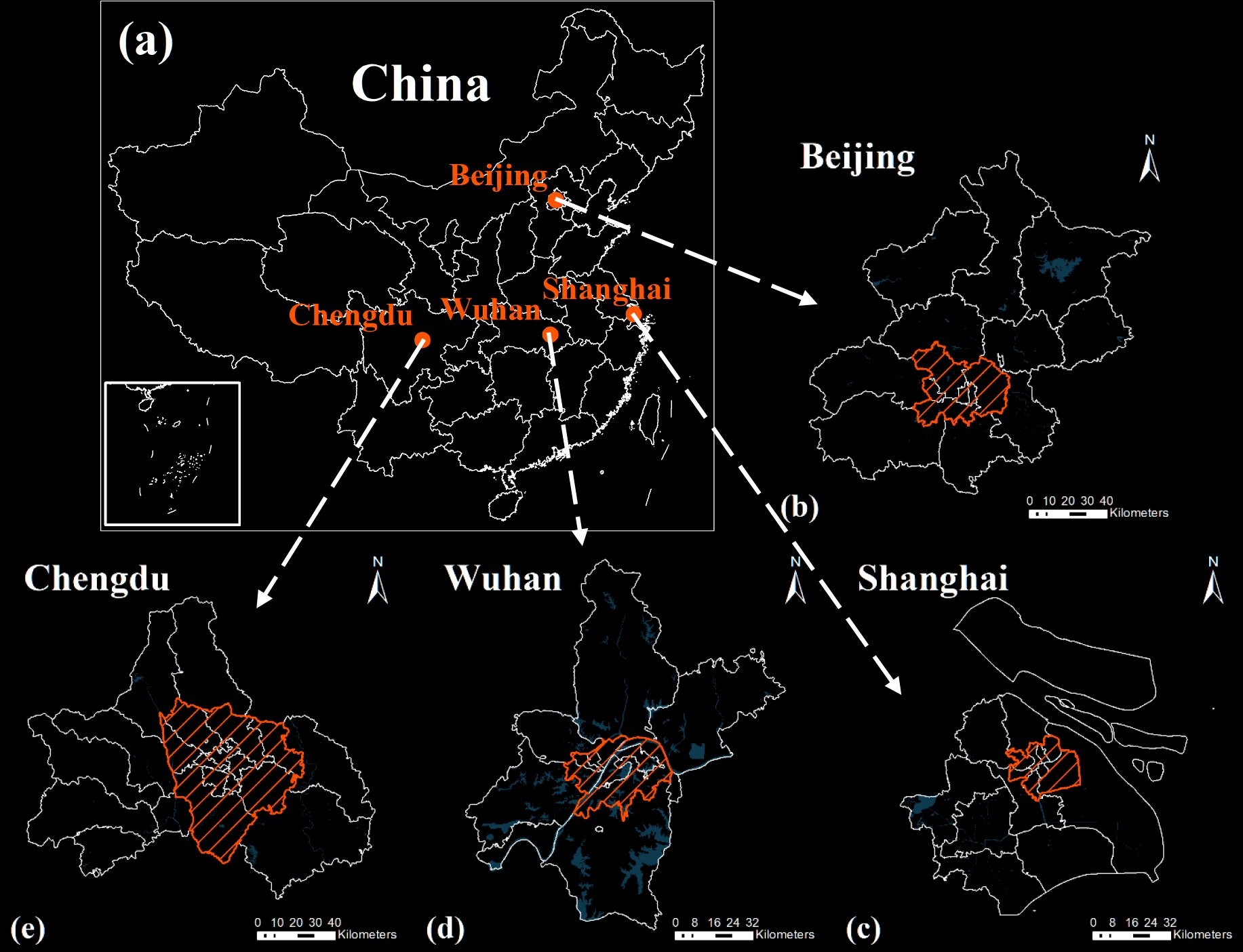
The study areas: (a) map of China; (b) map of Beijing, China; (c) map of Shanghai, China; (d) map of Wuhan, China; (e) map of Chengdu, China. The shaded area refers to the central urban areas of each city