The Geography and Equity of Crowdsourced Public Participation for Active Transportation Planning


Abstract

This paper explores the geography and equity of public participation methods in Austin, Texas, focusing on active transportation planning. It compares traditional in-person meetings with digital approaches, including a public participation geographic information system (PPGIS) and a smartphone platform for crowdsourcing input on biking and walking routes. The study finds that online methods, especially the smartphone platform, enable broader geographic participation compared to in-person meetings. Interestingly, the smartphone platform shows alignment with lower-income areas, highlighting its potential to engage disadvantaged communities. This research underscores the importance of considering both geography and equity in transportation planning and suggests that crowdsourcing tools can enhance public participation across diverse populations.


Team

Greg P. Griffin and Junfeng Jiao

Acknowledgments

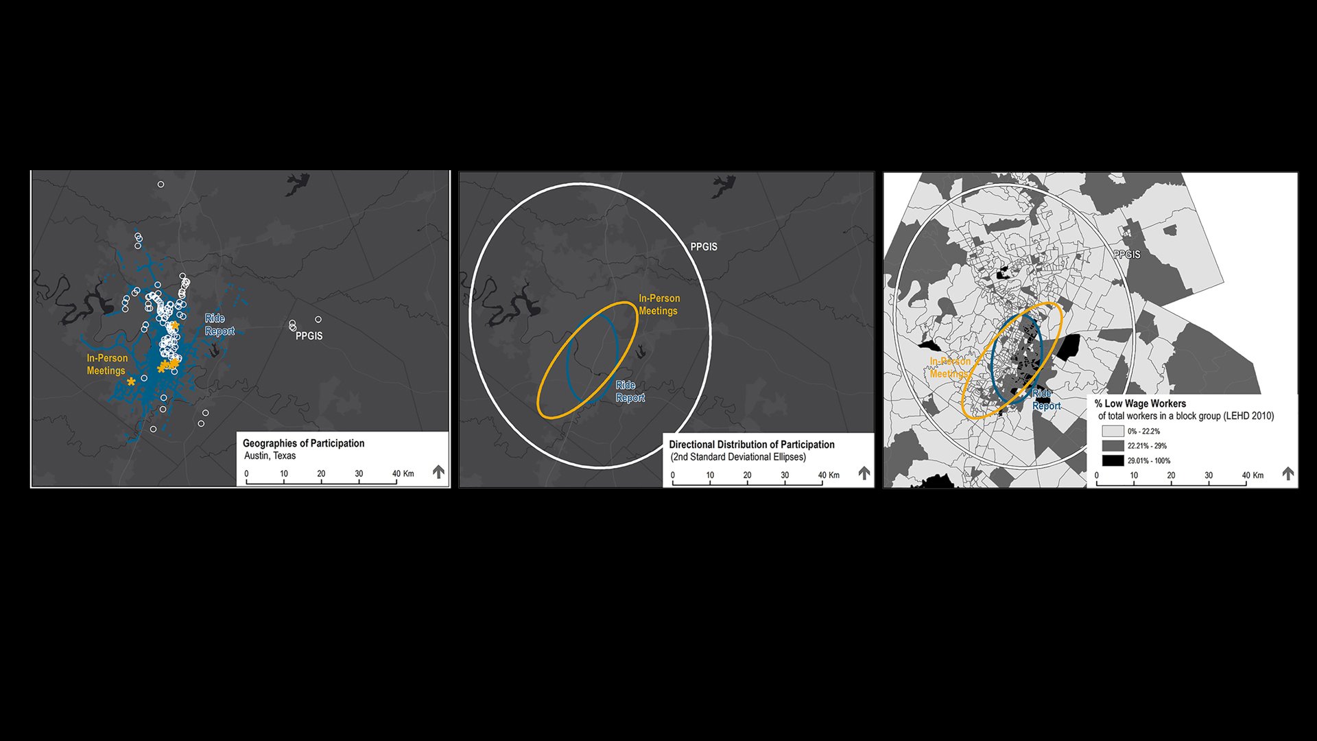
This paper was supported by a grant from the U.S. Department of Transportation’s Cooperative Mobility for Competitive Megaregions University Transportation Center. However, the U.S. Government assumes no liability for the contents or use thereof. Kelly Porter and Leena Reese of the CAMPO kindly provided the PPGIS database. Additionally, this work benefited from the comments of five anonymous reviewers through the TRB Public Involvement Committee (ADA60).

The cover image is sourced from Pexels and is free of copyright issues.