Estimating E-Scooter Traffic Flow Using Big Data to Support Planning for Micromobility

A heat map showing the total number of trips started or ended at each location defined by a hexagonal grid. Each hexagon has a side length of 152 m (500 feet).

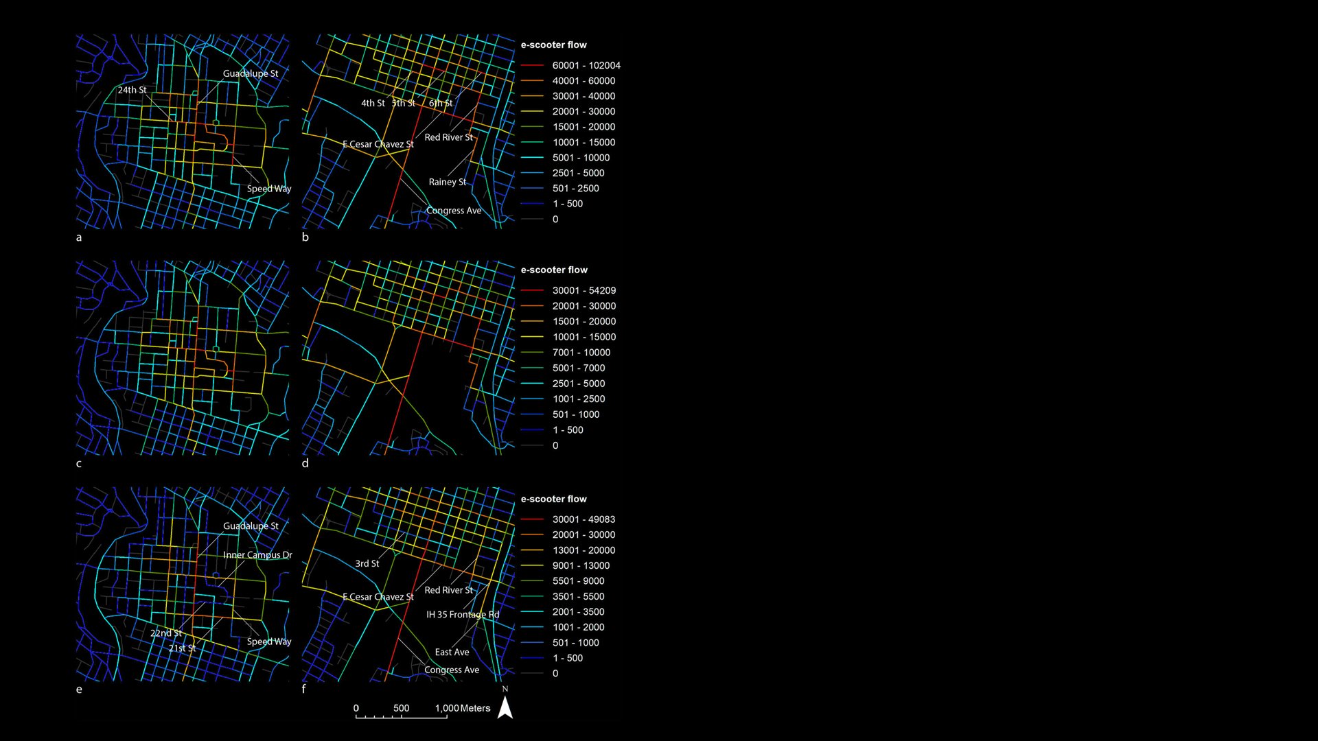
Estimated e-scooter flow patterns in Downtown Austin and around the UT campus. (a) Escooter flows around the UT campus, derived from the all-inclusive, shortest-path model. (b) E-scooter flows in the downtown area, derived from the all-inclusive, shortest-path model. (c) E-scooter flows around the UT campus, derived from the selective, shortest-path model. (d) E-scooter flows in the downtown area, derived from the selective, shortest-path model. (e) E-scooter flows around the UT campus, derived from the selective, most-direct-path model. (f) E-scooter flows in the downtown area, derived from the selective, most-direct-path model.

Abstract

The paper introduces a practical method for estimating e-scooter flow patterns using open datasets that track trip origins and destinations. By leveraging this data, the authors demonstrate how their models can assist cities in optimizing support for shared micromobility services. Additionally, the generated information can enhance the analysis of e-scooter trips for more precise insights.

Team

Chen Feng, Junfeng Jiao & Haofeng Wang

Disclosure Statement

The authors declare no conflict of interest of any kind.

The cover image is sourced from Pexels and is free of copyright issues.